Mapping the secrets of the ocean floor
by André Luiz de Oliveira
Have you ever got lost exploring a new place while travelling? Even in our own hometown, sometimes we get completely confused by streets and signs trying to reach our favourite ice cream shop and need help finding ourselves. Our first instinct is too open any map app in our smartphones and add the address we are looking. Now just imagine that you are trying to locate a small tubeworm clump, or a swarm of vent shrimps in the enormous area entailing the Pacific Ocean's surface in the complete darkness. Pretty hard, no?
Scientists have a way of accessing the complex and mesmerising underwater landscapes, and for our lucky, the site we are heading for our experiments (East Pacific Rise 9°N) is well studied and mapped. The type of data collected from measuring the depth of the ocean floor, and all the amazing geological formations that are there, such as mountains, canyons, trenches, is called bathymetric information. With the help of bathymetry, and the associated cartographic location, scientists can find their favourite hydrothermal vent animals and favourite vent sites with the same accuracy you will find your favourite ice cream place using your mobile phone. The only difference is that we need a really big boats to bring us to the place.
But how this data is collected? One really important tool is sonar systems. These systems emit sound waves that travel through the water and bounce back when they encounter the seafloor. By analyzing the time it takes for the sound waves to return, scientists can calculate the depth at different locations, much like how bats use echolocation to navigate in the dark!
To facilitate even more our lives, there is a tool that can load all this information gathered from the ocean floor and display graphically for us. It is like a Google Maps, but for the ocean floor. This tool is called GeoMapApp. It's free as scientists have put a lot of effort to produce and share bathymetric data all around the globe.
So why not checking how the seafloor of the beach you are going in your next vacations look like, even before dipping your toes into water?
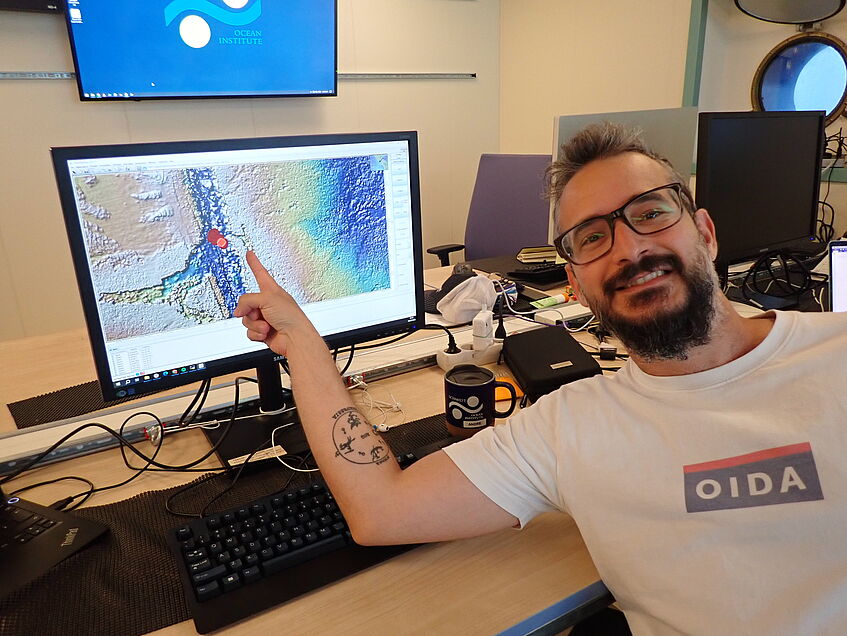
The bathymetrist. Attribution: Salvador Espada (CC-BY-NC-SA 4.0)